This 4 miles self-guided tour will take you about 2 hours to complete if only walking and taking pictures; much more if you visit the various recommended places on the way like the United Nations or the Ford Center, to name just two of them.
This walk is now only available on Payhip in pdf format with a clickable map and updated descriptions.
In this pdf you will also find:
- the list of Highlights.
- the Metro stops to get there and back and infos for Buses.
- tips about restrooms, places to sit and eat.
- details about a particular place you will find on your route.
You can download it (or just the map of the walk) to your phone to help you in your discoveries.
This will then allow you to live a unique experience of the city far from what you might find elsewhere.
If you purchased the Boston NYC book, this download will be free for you, just send me a note for an access code for this walk if you don’t have it already.
The description below, incomplete and with cropped photos, gives you an idea of this walk before you decide to buy it
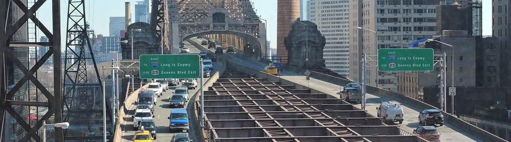
A: Take the… and once you are tired of looking at people …exit on …. and turn left.
If you have shoes to wax, now is the time: shiners are on your left.
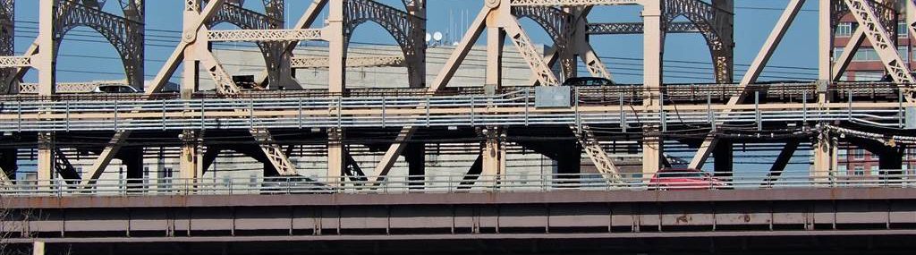
In front of you and easier to photograph, the stunning Italian-Romanesque building …
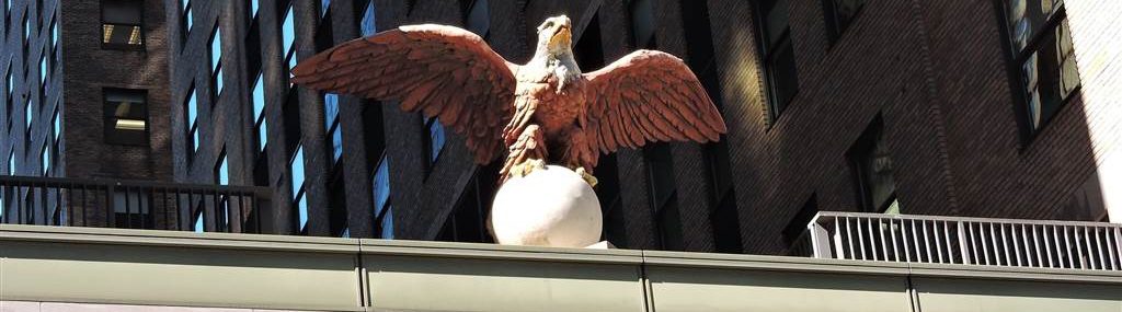
Turn left again to follow… and have a look at the eagle that overlooks the entrance on that side, then take …. to the right.
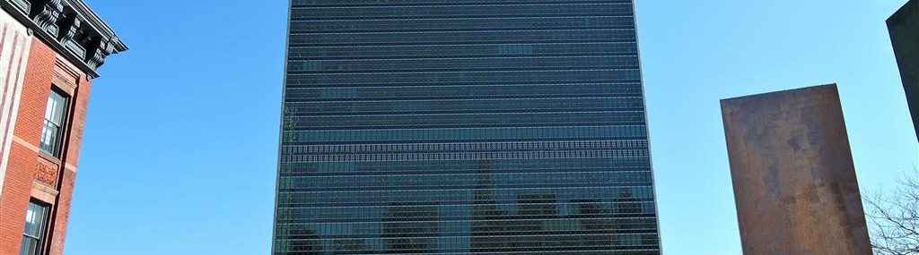
In front of you, in the distance, the bluish building of …
B: Before you go there, don’t forget to admire the … on your right then a little further, the …
On …, you are in the middle of various … Foundation building.
After some renovation in 2017-2018, it’s art gallery specializing in …is open again. Even if you don’t want to see what’s there, enter the building to admire its public atrium, a lush garden in the city.
After that, you’ll soon reach…, a neighborhood of neo-gothic-style buildings built in the 1930s and planned as an ideal city surrounded by a private park. Its purpose was to keep middle-class people from fleeing to the suburbs, and it was replacing collapsing multi-family housing built near old slaughterhouses.
The park is now accessible to all and also offers calm and greenery in the middle of the city.
C: At the end of …, go down the staircase. It leads to another small park, this one dedicated t… It’s not uncommon to see people protesting here against oppression in the world, …
You can visit part … from Monday to Friday; yet it’s better to book your ticket in advance and allow at least two hours to first … You’ll join a tour that will tell you what t…do and show you, among other things, …
In any case, don’t miss the sculptures of its park and opposite, …
D: Once out, take …and turn left.
Here you’ll find, after a …. and its art gallery.
Next door, a Catholic church with contemporary architecture,….. It has a small outdoor garden and fish ponds, and for 1 dollar, you can light a candle inside.
If you prefer more secular places to rest and see people,…. is wide and has benches in its center, with another garden along the walls on the left.
Once at…, you’ll find an open air market on Wednesdays.
E: You must now follow … for about ten blocks before reaching the …..
Before and if you like antiques, number … could mark the end of this trek sooner than expected as the vendors there, on 3 floors and with unique and authentic pieces, could keep you busy for a while.
If you are intrigued by …, on your right, is home to … but also a cultural center with an art gallery and a local specialty shop with ….
Otherwise, look on your left at all the skyscrapers of this part of the city.
In the avenue itself, you’ll find many restaurants and a variety of small shops geared toward the needs of its local residents.
When you are at the …, go up the stair to take ….
For the price of a metro ticket, it will take you in ….
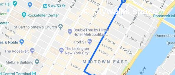
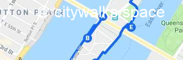
You’ll now be at the start of the second part of this trek and here is the map.
A: At the exit of t… turn left to find a small… kiosk where you can buy…
Otherwise go under the bridge to reach the ….
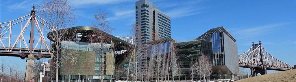
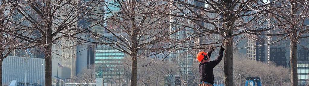
The promenade along … is lined with trees and benches and leads to…, with beautiful views of Manhattan on your right. On your left, … with its new and futuristic buildings that bread the industries of tomorrow.
B: You can go on … to take a look at its architecture or just have a drink in the sun.
C: Otherwise, continue to stroll along the river to reach the….
Once inside, you’ll soon see … ruins that remind you that for a very long time, after being occupied by the American Indians, the …because of all the hospitals it housed.
…, at the end of it, is made of white granite and faces … It’s a tribute to ….of the 4 freedoms (freedom of speech, worship, want and fear), a calm place in the middle of the water with numerous trees and great opportunities for photos.
D: To return to the …, leave the… by where you entered it, unless the east exit is open.
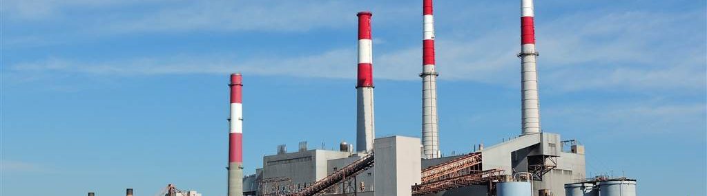
In any case, go and now walk along …. and, on your left, the 4 white and red chimneys of …
Once under t… again, you have three choices to end this trek: take t…, find, a little further on your right, the …. for a trip …towards Astoria or Wall Street …., or go a little further on your left to find t…
You can also keep walking along the river until you reach a passage on your left under and between some residential buildings. It will allow you to find ….and the beginning of Walk in NYC # 6, along the East River, part 3.
This walk will open you up to another world as …. your final destination, is very different from ….
Convinced that this walk will be exceptional? Find it on Payhip.